



























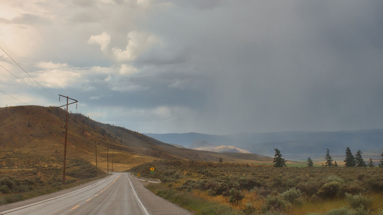
Highway 97 is moving again through one of British Columbia’s most heavily disrupted wildfire zones, but the reopening is far from a return to normal. The main north-south route through Summerland has been opened to public traffic for a tightly controlled 12-hour window each day as crews continue battling the massive Bald Range wildfire. Drivers can pass through between 7 a.m. and 7 p.m., but they cannot stop, turn onto side roads or enter evacuated neighbourhoods without authorization.
The restrictions underline how fragile the improvement remains. Thousands of residents are still displaced, the wildfire remains out of control, and emergency officials have warned that conditions along the highway could change with little notice.
Highway 97 Is Open, but Only During Daylight Hours
The limited reopening restores a crucial connection through the Okanagan after Highway 97 was shut as the Bald Range wildfire raced toward Summerland and Okanagan Lake. Traffic is being permitted through the affected corridor from 7 a.m. until 7 p.m. each day. Officials have specifically asked motorists not to arrive before the morning opening, an indication that the highway is still being treated as part of an emergency work zone rather than an ordinary transportation route.
The 12-hour schedule also creates a clear divide between public travel and wildfire operations. Once the road closes to general traffic in the evening, crews can continue working through the night without the added complication of regular vehicles moving through the area. Authorities say the arrangement depends on fire behaviour and the operational requirements of the BC Wildfire Service, meaning the schedule should not be treated as permanent.
Drivers Cannot Stop or Leave the Highway
One of the most unusual conditions attached to the reopening is also one of the most important: ordinary motorists are not allowed to stop or exit Highway 97 while travelling through the restricted area. The road is functioning strictly as a through route. That means pulling over for photographs, checking on property, turning into a neighbourhood or taking an unscheduled break inside the evacuation zone is prohibited.
Those rules reflect the hazards still present around the highway. Firefighters, utility workers, police and other emergency personnel may be operating beside the roadway, while nearby properties remain under evacuation orders. The restrictions also prevent drivers from creating congestion in places where emergency vehicles may need immediate access. Officials have warned that failure to follow the rules could result in the highway being closed to public traffic again, making individual driving decisions capable of affecting thousands of other travellers.
The Speed Limit Has Been Cut to 70 km/h
Drivers accustomed to Highway 97’s normal pace will have to slow considerably through the affected corridor. Emergency authorities have reduced the speed limit to 70 kilometres per hour, with workers potentially operating on or directly beside the roadway. The lower limit gives motorists more time to react to traffic control personnel, equipment, smoke, debris or other conditions that would not normally be present on a major highway.
The reduced speed also reinforces that the reopening does not mean the wildfire emergency has ended. Even where pavement appears clear, the surrounding landscape can remain unstable. Burned trees, damaged utility infrastructure and active firefighting operations can create risks long after flames have moved elsewhere. Drivers may pass stretches of seemingly unaffected community followed quickly by areas showing heavy fire damage. Authorities are therefore asking motorists to follow signs and directions from emergency crews rather than relying on normal driving expectations.
Evacuated Neighbourhoods Remain Off Limits
Reopening the highway does not reopen Summerland’s evacuated neighbourhoods. The Regional District of Okanagan-Similkameen has stressed that there is no general access to side roads leading into areas under evacuation order. At the time of the limited highway reopening, the entire District of Summerland remained under an evacuation order covering 5,688 properties, while hundreds of additional RDOS and Penticton Indian Band properties were also affected by orders or alerts.
That distinction matters for displaced residents who may see Highway 97 open and understandably hope that access to their homes is close behind. Emergency officials say the evacuation-order area is still unsafe and that there is no fixed timeline for general re-entry. Before people can return, authorities must consider utilities, electricity, roads, waste services and other safety issues. Reopening a transportation corridor is therefore only one part of a much larger recovery process.
Temporary Access Passes Are the Main Exception
Some people with urgent reasons to enter evacuated areas can apply for temporary access permits, but approval is tightly controlled. The RDOS says applications are being reviewed individually according to safety conditions and the circumstances behind each request. Receiving permission is not automatic, and simply submitting an application does not give a resident the right to approach a roadblock or enter the restricted area.
Officials have also warned applicants not to wait at checkpoints while a request is being processed. Anyone who arrives without an approved permit can be turned around, while repeated applications will not accelerate the decision. Permit holders are given instructions about where they may enter, with Highway 97 access directed through designated points such as Prairie Valley Road. The system is intended to accommodate genuinely urgent needs without undermining evacuation controls or interfering with firefighters and other emergency personnel working inside the zone.
The Fire Is Still Burning Out of Control
The highway reopening comes while the Bald Range wildfire remains classified as out of control, making the decision notably different from reopening a road after a fire has been contained. As of Thursday, the blaze was mapped at approximately 19,149 hectares, or more than 191 square kilometres. That represented an increase of roughly 700 hectares from the previous day’s mapping as the wildfire continued burning across multiple flanks.
Those numbers help explain the cautious highway rules. A fire covering more than 190 square kilometres is larger than many Canadian municipalities, and its perimeter passes through difficult terrain where suppression can take considerable time. Smoke was still visible from areas along Highway 97 after the reopening, and crews were observed dealing with hot spots. The road may be passable, but the landscape around it remains part of an active firefighting operation rather than a completed disaster zone.
Extreme Drought Keeps the Risk Elevated
Rain has offered little meaningful relief. BC Wildfire Service information reported by local media showed the Bald Range fire area had received only about two millimetres of rain since July 1 and none since August 1. The Okanagan had also reached Drought Level 5, the highest level in British Columbia’s drought classification system, leaving vegetation exceptionally dry and capable of supporting renewed fire activity.
Weather adds another layer of uncertainty. Officials have warned that stronger winds, thunderstorms and atmospheric instability can quickly change how the fire behaves. A corridor that appears relatively calm during one part of the day can become more dangerous if wind direction shifts or fire activity increases. That is why DriveBC has repeatedly emphasized that conditions may change with little or no warning. The reopening gives travellers access, but wildfire behaviour ultimately determines whether that access can safely continue.
The Highway Offers a First Look at the Damage
For some evacuees and travellers, the reopening provided the first ground-level view of the Summerland area since the emergency began. Canadian Press reporting described sections visible from Highway 97 as appearing largely unscathed, a potentially reassuring sight after days of dramatic evacuation scenes. Yet the view from the highway tells only part of the story because much of Summerland and the surrounding affected countryside cannot be seen from the route.
Other locations show how destructive the fire became. The La Punta Norte inn on the shore of Okanagan Lake, about seven kilometres from Summerland, suffered severe damage where the wildfire crossed Highway 97 and moved toward the water. Nearby hillsides have been blackened, while firefighters continued working on hot spots after the road reopened. The contrast between intact stretches and heavily damaged properties illustrates how uneven wildfire destruction can be.
The Closure Had Disrupted a Major Okanagan Route
Highway 97 is one of the Okanagan’s most important transportation corridors, connecting communities including Penticton, Summerland, Peachland, West Kelowna and Kelowna. Its closure forced travellers to navigate much longer alternatives at a time when thousands of residents were already moving between evacuation centres, temporary accommodations and communities offering support. Commercial vehicles also faced separate routing requirements because some emergency detours were unsuitable for heavy traffic.
A passenger-vehicle alternative involving Forest Service Road 201 and Highway 33 remained available during the disruption, but DriveBC warned that the forest service road is not built to normal highway standards. Officials recommended travelling during daylight, carrying additional food and water and beginning the trip with sufficient fuel. Commercial vehicles were directed toward numbered highway alternatives instead. Restoring even limited access to Highway 97 therefore removes a significant logistical obstacle for regional travel.
Nighttime Closures Give Emergency Crews Room to Work
Closing the corridor again at 7 p.m. is not merely a traffic restriction. The District of Summerland says the nighttime closure is intended to give crews access to continue their work without public traffic moving through the area. That can include wildfire suppression, utility repairs, hazard removal, road inspections and other recovery operations required before evacuated communities can safely reopen.
The arrangement effectively turns Highway 97 into two different roads depending on the time of day. For 12 hours, it serves motorists moving between communities. For the other 12, it becomes an operational corridor serving the emergency response. That balance helps explain why authorities are so concerned about drivers obeying the daytime restrictions. Every unnecessary stop or unauthorized exit can complicate an operation that must keep transportation moving while still preserving access for crews dealing with an active, unpredictable wildfire.
The Wildfire Has Already Taken a Heavy Human Toll
The highway reopening provides a measure of progress after an emergency that forced more than 20,000 people from their homes across affected parts of British Columbia. Summerland, a community of roughly 12,000 residents, was evacuated as the Bald Range wildfire advanced rapidly toward populated areas. Nearby Peachland and surrounding communities were also heavily affected as residents travelled north or south looking for safe accommodation.
The disaster has also been deadly. Police confirmed that an 80-year-old woman died in the Meadow Valley area northwest of Summerland, while reporting from the region described the nearby community of Faulder as largely destroyed. During the early stages of the emergency, dozens of people were rescued after shifting fire conditions cut off escape routes. Those experiences give added weight to officials’ insistence that an open highway should not be interpreted as permission to enter evacuated areas.
Reopening the Road Is Progress, Not an All-Clear
For residents and businesses across the Okanagan, seeing vehicles moving through Highway 97 again is an important sign that emergency crews have been able to reduce at least some immediate transportation risks. It reconnects Penticton with communities farther north and eases pressure on detours that were never intended to absorb normal Highway 97 traffic. After days of closures and uncertainty, even limited mobility can make everyday tasks considerably easier.
But nearly every condition attached to the reopening carries the same message: the emergency is continuing. The fire remains out of control, evacuation orders remain in place, access to neighbourhoods is restricted and weather could alter conditions rapidly. Officials have explicitly warned that Highway 97 can be closed again with limited notice. For now, the 7 a.m.-to-7 p.m. window represents a carefully managed compromise — enough access to reconnect the region while keeping crews and evacuated communities protected.